Photo Mapping Deployed to Enhance Effectiveness of Drug Interdiction Efforts
in Afghanistan
By Kevin P. Corbley
The War on Terror is fought on many fronts with a variety of tactics and technologies. In Afghanistan, drug interdiction has been implemented as a tactical weapon aimed at disrupting the flow of cash that finances some terror groups and their activities. With the stakes continuing to grow, the U.S. government and its allies constantly seek more efficient methods to curb the trafficking of illicit drugs from Afghanistan and other nations.
Working closely with an international contingent in Afghanistan, UXB International of Blacksburg, Va., and Dubai, UAE, has played a major role in developing and implementing procedures for finding and destroying the poppy fields that produce much of the world’s opium and heroine supply. As part of DynCorp International lead Afghan Eradication Force (AEF), UXB International helped devise an inexpensive and relatively simple geospatial technique using GPS-based photo mapping to enhance the safety of poppy eradication activities and make it easer to verify their effectiveness.
Locating Poppies
The poppy fields of Afghanistan are known to produce particularly potent forms of opium and heroine, which demand high prices on the streets of Europe, Asia and the United States. The poppy plant is harvested by scratching the bulb at the head of the stem, which makes the opium-based sap seep out so it can be collected. Opium is the initial product, but it can be further refined to produce heroine.
Steady increases in the Afghan supply over the past several years prompted the International Narcotics Law Enforcement Program to focus on cutting off the illicit drug flow at its source – in the country’s rugged interior mountains. The three primary players in the Afghan drug interdiction program are the governments of Afghanistan, Great Britain and United States, with the British being the lead agency. UXB International, which specializes in the disposal of unexploded ordnance, received a subcontract through DynCorp International to assist in destroying the poppies in the fields where they grow.
“AEF’s job is to go into a specified area, find the poppy plants, cut them, dispose of them, and verify the work,” said Pat Fogleson, a UXB International contractor and retired U.S. Army officer.
Fogleson explained that this entire process begins and ends with application of geospatial technology. Before the eradication teams head into the mountainous Afghan terrain, an international board obtains remote sensing satellite imagery of the country and examines different regions to select target areas that warrant further scrutiny. Imagery analysts typically identify likely poppy growing sites based on a combination of spectral and environmental evidence gleaned from the satellite images.
“Poppies can be identified by their spectral signature in multispectral imagery,” said Fogleson, “but this signature is shared by several other plants in the region, so the imagery analysts look for environmental conditions that favor poppy growth.”
Poppy plants, known by many for their bright red blooms, require arable soil and adequate water supplies. With mechanical irrigation unavailable in remote parts of the country, the need for water usually means the poppies are planted very near rivers and streams. Preparation of the soil for poppy planting is also rather unique, yielding an early-season plowing pattern that can often be spotted in the imagery.
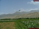
Once suspected poppy fields are located in the imagery, the coordinates are provided to the field teams for closer visual inspection. The crews depart by helicopter to the targets, often hidden in mountain valleys, to confirm and pinpoint the locations of actual poppy fields. These airborne missions typically require a flying altitude of about 150-200 feet above ground level to visually verify that poppies are indeed growing in the fields.
On each flight, the teams take two critical pieces of equipment – a high-end digital camera and a highly accurate handheld GPS receiver with external antenna. Just before take-off, they synchronize the two devices by taking a digital photo of the GPS screen. This simple step enables them to correlate every picture taken that day with their accurate GPS location points using GPS-Photo Link photo mapping software from GeoSpatial Experts of Thornton, Colorado, USA.
Referencing the digital photos of poppy fields with their accurate location coordinates is a basic yet crucial aspect of each mission, explained Fogleson. “We used to try to take photos and then copy down their GPS coordinates on paper – while hanging out the open door of the helicopter. It didn’t work so well.”
Once the screen of the GPS receiver is photographed, the GPS unit is programmed to collect a track log throughout the flight, recording one location every 10 seconds. The photographer for that mission focuses on taking pictures of the confirmed poppy fields from several angles without worrying about jotting down the locations.
Back at the base each night, the digital photographs and GPS track logs are downloaded from their respective devices onto a laptop computer running the GPS-Photo Link software. Using the mission start time displayed on the screen of the GPS unit in the first photo taken, the photo-mapping software correlates each subsequent digital photo, which is time-stamped in the camera, with its location points in the track log. The software then affixes the location coordinates along with acquisition time and date on each photograph.
“We know precisely where each photo was taken, and we can mark these locations on the maps provided to us by the program administrators,” said Fogleson. “If we had a GIS in the field, the software would integrate the digital photos as attributes on the map, but since we don’t have GIS, we mark the map, attach the photos and send a report to the embassies in country.”
Eradicating Poppies
Soon after confirming poppy field locations from the air, AEF teams set out on vehicle to find the crops in person. This ground-level visit is necessary for two reasons. First, the poppies must be identified absolutely through an up-close inspection. Second, an expert must assess the growth stage of the plants.
“This is critical because if we destroy the plants too early in the growing cycle, they can grow back,” said Fogleson.
The process of photographing the field is repeated on the ground during this visit to verify the poppies’ location and stage of growth. As occurred in the air, a GPS receiver is used to pinpoint the locations of each photograph. The photographer typically tries to capture digital pictures from as many corner points of the field as possible. When these photos are correlated with their GPS locations in the photo-mapping software, the team will be able to make very accurate acreage calculations for each field.
Due to inherent dangers involved, the crews want to get out of the field as quickly as possible, and the photo-mapping technique lets them make a fast and accurate assessment of field size in a matter of minutes.
Once again, the photos and annotated maps are supplied to program administrators along with written reports. The officials take into the account the locations, size and growth-status of various fields to prioritize and plan the cutting missions that will follow. When the time is right, a contingent of up to 400 individuals will trek back into the mountains to destroy the crops in selected fields.
“The majority of the cutting team is composed of Afghan police, but there are also about 30 international advisors,” said Fogleson. “The Afghanis are in charge of the cut, and the internationals are there to advise, provide training and verify the cut.”
There are three methods deployed to destroy a poppy field. The first is easiest – the team simply plows the plants under the soil using tractors. Getting these vehicles to remote and rugged fields is often difficult, however, so the more common technique is to attach drags and cutter blades to small four-wheel-drive vehicle and run them back and forth through the crops. The third technique, required in smaller fields, is for men to hack down the plants with sickles.
Verification of the cut is absolutely crucial, explained Fogleson. Once the poppies have been eradicated in the entire field, the digital camera and GPS receiver are once again pressed into service. Photos are taken at every corner point of the destroyed poppy field. As was done before, the photos of the destruction are correlated with their GPS location points in the GPS-Photo Link software and provided to program officials in Kabul. A map analyst there confirms the right fields were destroyed and that the correct acreage was eliminated.
“The location-stamped photos enable us to prove with a high degree of accuracy that an entire field was cut,” said Fogleson. “It is very, very important to physically verify a cut because with the amount of money involved, it would be too easy for the drug trade to pay people to miss-represent the area cut…if a team is sent to destroy 200 hectares of poppy in a given field, it can be verified that 200 hectares were cut.”
Applying Photo Mapping in Law Enforcement
Looking at the big picture, the team believes the deployment of the photo-mapping technique has improved the overall accuracy of drug interdiction efforts in Afghanistan. The U.S., British and Afghani governments use a variety of technologies, including satellite imagery, to estimate the nationwide acreage of poppy crop in the country every year. The GPS-verified cutting technique enables them to more accurately determine the percentage of crop destroyed, which in turn helps predict how much opium and heroine won’t be reaching the streets.
The other advantage of photo mapping is its simplicity and low cost, according to Fogleson. Today, anyone can be taught to use a digital camera and a handheld GPS device, both of which are plentiful in the public safety community. Fogleson views photo mapping as another means of collection evidence and believes this technique can be applied extensively in drug interdiction efforts, as well as general law enforcement activities elsewhere in the world.
About the Author – Kevin Corbley is a communications consultant specializing in geospatial technology. He may be reached at kevin@


