Westwood Professional Services uses GeoJot+ for Phase 1 and Phase II Environmental Site Assessment Reports (ESA). Running GeoJot+ on a mobile device, staff:
- Collect photos and data to support the analysis of hydrological conditions
- Document inspection of the subject property or surrounding areas
- Capture geolocated digital photos with descriptions
Established in 1980, CERCLA established a liability scheme for the release or threat of release of hazardous substance on a property. The property owner of a site can be held liable regardless of fault, simply by virtue of ownership. Phase I Environmental Site Assessment (Phase I ESA) is a common report used to identify potential or existing environmental contamination liabilities for real estate properties. The report allows the purchaser to qualify for protections under CERCLA.
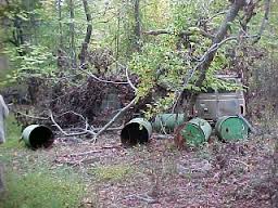
The Phase I ESA includes a historical records review of the property, interviews with owners, occupants, neighbors, and local government officials, and an inspection the property by an environmental professional. GeoJot+ is a particularly useful tool during the site inspection of a property. Photos along with data describing the photos are stamped with location, date, time, and the person collecting the data. The data collected is often included as an appendix at the end of the report. Not only is GeoJot+ used by environmental consultants for Phase I assessments but it is also used an approved tool used by the EPA. GeoJot+ strengthens the chain of evidence while saving countless hours generating inspection reports.
The finding of a recognized environmental concern (REC) may lead to further investigation including a Phase II Environmental Site Assessment (Phase II ESA). The main difference between a Phase I and Phase II ESA is the degree to which a site is inspected. A Phase I is noninvasive, whereas Phase II is invasive – generally requiring testing of soil or groundwater samples or building materials. Once again, the GeoJot+ mobile app is used to visually document the location and condition of an area.
Mobile Data Collection
Westwood has created forms for each type of project. The ESA form includes: Project name, Site ID, ASTM Standard Specific Reconnaissance Item, and Notes/Description. GeoJot+ Automatically records location, date, time, and the person using the app. For consistent data collection, they share forms via email or by synchronizing forms on mobile devices via the cloud. They collect data by taking a photo and filling out the form. Then GeoJot+ automatically sends data back to the office via the cloud for output generation.
Managing users
Westwood can easily transfer the the GeoJot+ mobile app between devices. If someone forgets to take their company-provided iPad into the field, they can quickly transfer the app to their smartphone. If a employee leaves, they can easily transfer GeoJot+ to a new device.
Reports and Other Output
GeoJot+ offers a variety of output options. Templates in the desktop app are used to consistently generate reports, maps and other output. GeoJot+ output is usually a customized .pdf attachment added to the Phase I or Phase II Environmental Site Assessment Report. In addition to the reports, Westwood also generates shapefiles of the photo points to create detailed maps. For simplified sharing, they use GeoJot+ to create Google Earth maps. Once the project is over, Westwood archives the shapefiles containing all of the photos and data.
What’s next? Try GeoJot+ and download the engineering data collection forms.


