Upcoming Webinars
- Wednesday, January 16th, 2012
From Field Data Collection to Final Reports with GeoJot+
Learn how GeoJot+ can maximize the efficiency and accuracy of your field teams saving you money and giving you the competitive advantage for less than $1 per user per day. The new subscription-based solution is optimized for enterprise use and built on GeoSpatial Experts’ popular GPS-Photo Link and GeoJot products. Register now to learn more!
Click here to receive email about upcoming webinars from GeoSpatial Experts.
Webinar Archive
- April 4, 2012
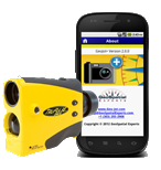
GeoJot for Android
Watch the recorded webinar showing you a sneak preview of the GeoJot field data collection app for Android. You can also view the transcript of the Q&A session.
- February 8, 2012
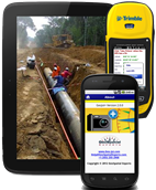
GeoJot- the app for photo & attribute data collection on your smartphone or tablet
Watch the recorded webinar. We apologize if you were not able to sign in to the webinar, it reached capacity within the first few minutes of the event. You can also view the Q&A session in text format.
- Dec. 9, 2011: GeoJot - the iPhone/iPad app for photo and attribute data collection
Due to the popularity of this sold-out webinar, it will be offered again in early 2012. See the powerpoint slide presentation.
Read our case studies to see how people across the globe are photo mapping to solve business problems.
GPS-Photo Link Sample Reports
Standard Report - Overview map, Each page: single photo, two maps, attribute table (This sample has additional information on page two that was added by the user after the report was created.)
Condenced Report - Overview map, Each page, up to 3 photos with attribute table and map
Contact Sheet - Single overview map at the top of each page. up to 8 watermarked photos per page. No attribute tables
Training Videos
Check out the extensive selection of training videos for GPS-Photo Link. Topics range from a quick overview of the program to in-depth training for each step in photo processing and output generation.
Try GPS-Photo Link yourself for free!
Download the FREE 15 day trial version and use with your own camera/GPS or use our sample data. Check out the training videos or quickstart guides; you'll be processing photos in minutes!
Review our sample output including .pdf reports, google earth files, watermarked photos, and shape files.
Please contact us with any questions!
|