Upcoming Webinars
- November 16, 2017 11am MST
GeoJot+ for Phase I and II Environmental Assessments
REGISTER NOW! See how your engineering firm can use the GeoJot+ app on smartphones and tablets to collect field data. Back in the office use the GeoJot+ desktop application to generate client reports for Phase I and Phase II ESAs.
Webinar Archive
- Wednesday, September 13th 2017
- How do I transfer photos from my device without using the cloud?
- How can I optimize my forms based on my Workflow?
- How do templates work in GeoJot+ Core?
- August 30th 2017
-
- How do group photos work?
- What can I do with the Admin Dashboard?
- How can I configure the app for multiple field users at one time?
- September 6th, 2017
-
- How do I use alternative maps for my reports?
- How do I set up Dropbox depending on the output I want to create?
- How do I use external GPS receivers to increase my accuracy?
- May 3rd, 2017
Field Data Collection with iPhones, iPads, and Lasers
Watch this webinar hosted by GeoSpatial Experts and Laser Technology Inc. to learn how your field team can collect consistent and accurate data, with minimal effort and training.You’ll see how the integrated GeoJot+ /TruPulse® laser system can work seamlessly with iPhones and iPads to:- Capture remote positions & height with a TruPulse laser, wirelessly transmitting data to GeoJot+ on a mobile device
- Collect geotagged photos and attribute data with your iPhones and iPads
- Automatically send all your data back to your office via the cloud
- Process your field data back in the office, mapping the results in ArcGIS or Google Earth, importing the data into a back end database, or creating reports and watermarked photos
- Easily transfer GeoJot+ App licenses among mobile team members using Apple and Android devices
- January 25th, 2017
Collecting Engineering Data With Smartphones and Tablets
Watching this 20 minutes could save you countless hours on field data collection and report generation. for this short mobile data collection webinar for Phase I and II ESAs, Culvert Inventories, Wetland Delineations and more. See how you can quickly use templates to make the reports you need for your clients. View the Q&A transcript.
- July 28th , 2016
Using higher accuracy GPS with GeoJot+
Watch this 20 minute mobile data collection webinar to learn more about how your team can couple the GeoJot+ app with a high accuracy bluetooth GPS puck, match GeoJot+ app data with a non-bluetooth GPS unit or tag GeoJot+ data with existing survey grade GPS coordinates.
- February 23rd , 2016
GeoJot+ for Trail Inventories
Watch this 15 minute webinar see how DOI agencies are using the GeoJot+ mobile app and desktop processing engine to document trail deficiencies, trail planning, and inventory trail assets like bridges and drains for FMSS. Don’t recreate the wheel, learn from others!
- February 23rd , 2016
GeoJot+ for Wilderness Characteristic Inventories
This 15 minute mobile data collection webinar will show you how to use GeoJot+ to collect solid photographic evidence for your inventory. Quickly document landscape conditions, large scale scenery and detailed photos of segments and routes, capture structures or intrusions on parcels.
- February 23rd , 2016
GeoJot+ for Facilties Inventories
Learn more about how NPS is currently using the GeoJot+ mobile app to document facility asset conditions in this short webinar. See how easy it is to use the GeoJot+ app. Get facility asset forms and templates for your project.
- January 29th , 2016
GeoJot+ for the Enterprise
This 15 minute executive webinar provides an overview of the new features of GeoJot+ for the Enterprise. Learn more about how the new functionality can streamline and simplify mobile field data collection for companies with 100 or more activations.
- January 29th , 2016
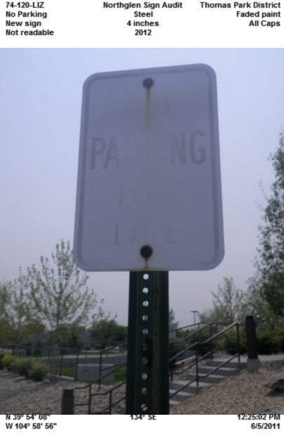
Sign Inventories with GeoJot+
Learn how government agencies are currently using the GeoJot+ mobile app for sign inventories in this15 minute webinar. Contact us for existing forms, detailed use cases and worflows.
- October 29th, 2014
Smartphones and Lasers for Utilities Field Measurements
Watch this 20 minute overview of mobile data collection for utilities. See how smartphones can be used with laser rangefinders for joint-use pole audits, right-of-way vegetation management, and proof of performance. Collect remote GPS location, photos, and data including heights and spans. Make additional pole measurements from the photos back in the office. Create reports and maps. Learn more about GeoJot+ for utilities.
- September 10th, 2014
Smartphones and Tablets for Pipeline Data Collection
This 20 minute executive webinar provides an overview of mobile data collection for pipeline regulatory compliance (last 10 minutes are Q&A). See how contractors and employees can quickly be trained to use their smartphones and tablets to capture required photos, data and location coordinates. Use the data to create reports, maps, and input for your backend database. View the slides, Q&A transcript or therecorded webinar.
- February 5th, 2014
Field Data Collection with Windows Mobile, Android, and Apple Devices
See how the newest release of the GeoJot+ field data collection system can now help you create an integrated field team of Windows Mobile handheld GPS devices along with Android and Apple smartphones and tablets. Easily transfer the app between devices. Get the most out of your equipment! View the Q&A transcript or the recorded webinar. If you have purchased GeoJot+ or signed up for a trial, download the Windows Mobile version.
- September 26, 2013
Field Data Collection in Education Using Smartphones & Tablets
See how to turn your students’ smartphones and tablets into field data collection tools. See how easily students can map their data in ArcGIS and Google Earth or create customizable reports. Download theslide presentation, view the Q&A transcript (coming soon) or the recorded webinar.
- April 10th, 2013
Field Data Collection With Smartphones, Tablets, and Lasers
Learn how to get the most accurate field data with your organization’s smartphones and tablets! By coupling TruPulse lasers with the GeoJot+ field data collection system, your field teams will collect consistent and accurate data, with minimal effort and training. Download the slide presentation, view theQ&A transcript or the recorded webinar.
- January 16th, 2013
From Field Data Collection to Final Reports With the NEW GeoJot+
Turn your organization’s smartphones and tablets into field data collection tools. Download the slide presentation, view the Q&A transcript or the recorded webinar.
Upcoming Mobile Data Collection Webinars
- Click here to receive email about upcoming webinars from GeoSpatial Experts.
Read our case studies
See how people across the globe are photo mapping to solve business problems.
Download a 15 day trail version
Sign up for a free 15 day trial of GeoJot+, our new field data collection solution.
Training Videos
The GeoJot+ tutorial series consists of 5 training videos covering: GeoJot+ trials, Setting up and configuring the app, List creation and distribution, Field data collection, and Managing users with the Administrator’s Dashboard. You can also view the GeoJot+ set up guide.
GeoJot+ Core Sample Reports
Review our sample output including google earth files, watermarked photos, and shape files, in addition to the .pdf and word files below.
Standard Report - Overview map, Each page: single photo, two maps, attribute table (This sample has additional information on page two that was added by the user after the report was created.)
Condensed Report - Overview map, Each page, up to 3 photos with attribute table and map
Contact Sheet - Single overview map at the top of each page. up to 8 watermarked photos per page. No attribute tables


