GeoJot+ Mobile App for Engineering
GeoJot+ mobile app is used by engineering firms across the world for a variety of projects. Geotagged photos with embedded field data provide ideal documentation for power delivery projects, development, construction, and environmental services. There is an easier way to collect the data you need more efficiently and accurately. Use the mobile devices your staff already carry or standardize on a mobile device within your organization.
Automatically upload data from your mobile devices via the cloud. Back in the office, process the data to create reports, maps, and photos watermarked with field data. Use this output for compliance documentation, analysis, and proof of performance. Check out the recorded webinar on using GeoJot+ for Engineering Projects.
- Stormwater Pollution Prevention Inspections
- Phase I and Phase II Environmental Site Assessment Reports
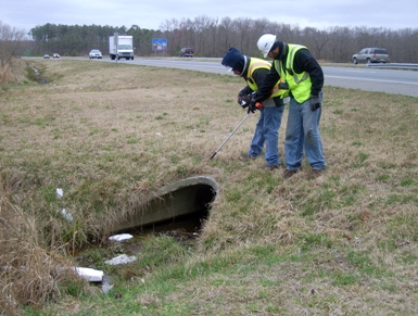
- Culvert Inventories
- Transmission Line Surveys
- Pipeline Surveys
- Wetland Delineation
- Avian Field Studies
- Erosion Control Inspections
- Site Assessments for Renewable Energy and Development Projects
- And More ….
Download GeoJot+ forms for Engineering. To learn more check out our use cases and recorded webinars. Download GeoJot+ engineering forms you can open using the GeoJot+ app on your mobile device.
Our training videos are a quick way to get started with the GeoJot+ app for mobile data collection. For larger teams, set up a private webinar with Geospatial Experts to discuss your needs.


