From field data collection to final reports
Main Menu
Main Menu
Products
GeoJot+
GeoJot+ Core
Case Studies
Webinars
Industries
Natural Resources
Utilities
Engineering
Asset Management
Land Management
GIS/GPS
Oil & Gas
Case Studies
Help
Training Videos
Webinars
Online Help
FAQ
Tips & Tricks
Support Form
GeoJot+ Login
About Us
Corporate Profile
History
Media Coverage
Press Releases
Blog
Resellers & Partners
Customers
Contact Us
Posts Categorized:
Media Coverage
Home
Blog
Category: Media Coverage
GeoSpatial Experts Includes New GPS-Ready Ricoh Camera in Photo-Mapping Bundle
Read More
Real Property Policysite
Read More
Extremely simple to use processing program
Read More
Ancestry Magazine
Read More
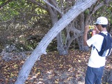
Hawaiian High School Students Map Beach Erosion with GPS-Photo Link Software
Read More
National Spill Control School Recommends GPS Photo Mapping for Disaster Preparedness
Read More
Powerful solution delivering easy and affordable digital photo
Read More
Mobile GIS and Digital Photomapping Speed Fieldwork, Reduce Return Visits
Read More
The value of current photography in military operations
Read More
GPS-Photo Mapping with Pentax Optio WPi
Read More
«
1
2
3
4
5
6
(current)
7
»