When people want to describe something, an outdoor asset for example, there are often a few key components they need in order to fully document that asset.
- Where is it? A problem easily solved with GPS which is built into just about everything these days.
- What does it look like? Take a photo! A smartphone camera usually does the trick, but sometimes people still need the optical zoom provided by a DSLR camera. A DSLR can be coupled with a standalone GPS.
- Other ancillary data – what is the condition? Does it have a unique ID? Who owns it? There could be 5 or 50 or more pieces of data that people need to describe the asset.
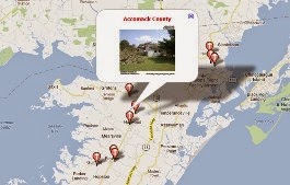
Taking a picture and collecting data provides photographic evidence at a specific place and time. This is useful for an asset inventory, a site survey, basic field work, compliance documentation, or proof of performance. The output can be displayed a photo map, visually representing the data in a way that is easy for anyone to understand. It can also be imported into a GIS and used with other data layers for analysis or archived in a backend database.
GeoJot+ allows you to get the most out of your existing hardware – the field data collection app runs on any Apple & Android smartphones or tablets, and handheld GPS units with Windows Mobile. Data can automatically be uploaded to the cloud and then pulled down to the final resting place of your choice. There processes the data through the accompanying GeoJot+ desktop app creating all the desired output. A picture is worth a thousand words, especially when it is a geotagged photo and contains other descriptive data in the EXIF header of the photo itself.


