Easy Field Data Collection for Electric Utilities A mid-sized public electric utility serving the approximately 50,000 customers in the south is using GeoJot+ to assure that their electrical systems model is current every day. An electrical system model needs to be accurately documented with up to date information to maintain safety and compliance, manage outages,… Read more »
Geotagging Photos Helps Prioritize Oil Spill Response in Gulf THORNTON, Colorado, USA, 21 September 2010 – Thousands of GPS-stamped photos showing the locations of sensitive habitats and wildlife impacted by the oil spill in the Gulf have helped decision makers determine where to deploy clean-up crews. These ‘geotagged’ photos are served out via the web… Read more »
Geotagged Photos Facilitate Requests for Federal Aid After Disasters THORNTON, Colorado, USA, 26 January 2010 – Brown County, S.D., relies on GPS-enabled digital cameras and photo-mapping software to speed the deployment of resources and facilitate requests for federal assistance following natural disasters. The photo-mapping process, known as geotagging, utilizes GPS-Photo Link software from GeoSpatial Experts… Read more »
Hawaiian High School Students Use GPS-Photo Link Software to Study Beach Erosion THORNTON, Colorado, USA, 6 September 2006 – Students at Kealakehe High School in Hawaii will be hitting the beaches this year with GPS-Photo Link software from GeoSpatial Experts of Thornton, Colo., to study the extent and possible causes of shoreline erosion. The study… Read more »
Public Health Researchers use Photo Mapping to Analyze Tobacco Ads near Schools Photo mapping, a process in which geotagged photographs are accurately placed on a digital map, is often used by public health researchers to graphically track the spread of disease within or across a geographic area. In 2007, Public Health officials in Greece applied… Read more »
Researcher Maps Ancient Tombs in Oman with GPS-Photo Link Software THORNTON, Colorado, USA, 27 August 2008 – An archaeologist from Michigan State University is using GPS-Photo Link photo mapping software to record the precise locations and conditions of ancient tombs in Oman. The researcher believes the tombs will provide insights into an ancient people known… Read more »
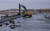
GIS Volunteer Recommends GeoSpatial Experts GPS-Photo Link for Disaster Response Work THORNTON, COLO., 31 October 2005 – A GIS analyst working on post-Katrina damage assessment in Mississippi found the GeoSpatial Experts GPS-Photo Link software to be a valuable tool in disaster clean-up efforts. Laura Horton, the GIS volunteer, said that if everyone had had access… Read more »
Volunteers map sled dog trail with GPS Published in Alaska Star on 1/8/2009 By DARRELL L. BREESE Members of the Alaska Arc User group volunteered their time and descended on the Beach Lake Sled Dog trails Dec. 6 with the goal of creating an accurate map of the established trail network. “They (the Chugiak Dog… Read more »