Google Photos has arrived. The new service unveiled at the Google developer’s conference last week is likely to be a huge hit. First, it allows you to back up all your photos for free. There is an app for both your computer and your smartphone to further simplify your life. There are a couple details… Read more »
I remember when GPS was only available in the 10lb size that fit in a backpack. I also remember when GPS was all but useless without post-processing for differential correction. How times have changed. We all take for granted now that GPS will be in the smartphones that have become our lifeline, but even that… Read more »
000001.jpg or 2014_123456. Not all that helpful when you have thousands of photos is it? Wouldn’t it be nice to be able to use the Search function in the Windows library to find the exact photo or group of photos you are looking for? Depending on how you collect your data, you can. Windows has… Read more »
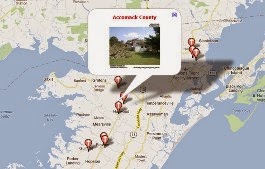
When people want to describe something, an outdoor asset for example, there are often a few key components they need in order to fully document that asset. Where is it? A problem easily solved with GPS which is built into just about everything these days. What does it look like? Take a photo! A smartphone… Read more »
Just a quick note, GeoJot+ users, please DO NOT upgrade to iOS 8.3. We are experiencing a couple of issues with the camera roll because of an Apple bug in the new operating system. We are working with them now to get it resolved. In addition, we know that Bad Elf is has reported a… Read more »
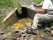
Most recently we have had conversations with users about their site inspection workflows. As a software development company, we spend much of our time sitting in an office working at a computer. Even if I can’t go out in the field with a customer, it is enlightening to hear about their realities – what forms… Read more »
So often in business, we put our heads down and just plow through our tasks. While it is always good to work hard, sometimes we need to remember to allot time to find ways to work smarter. For those of us who have been at our current jobs for a longer period of time, this… Read more »
GeoJot+ is photo-based field data collection, so camera quality is a concern for many of our customers. Below are links to 2 different articles about the best smartphone cameras this year. http://www.cnet.com/topics/phones/best-phones/camera/ http://www.tomsguide.com/us/best-phone-cameras,review-2272.html Both articles recognize the iPhone6 plus and Samsung Galaxy. These (or their recent predecessors) are the most common cameras we see among… Read more »
Both Android and iOS primarily target consumers not businesses. But ubiquitous in the workplace, the battle for dominance may be swayed by employers and employees concerns about the use of personal smartphones and tablets at work. Google first introduced the Android for Work initiative in the summer of 2014 and began formally launching the program… Read more »
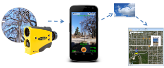
Learn how you can use a laser rangefinder with your smartphone or tablet for field data collection. Register for a free webinar presented by Laser Technology and GeoSpatial Experts next Wednesday April 10 at 1pm MDT. Use TruPulse lasers with your smartphones & tablets running GeoJot+ to wirelessly capture field data along with geotagged photos,… Read more »